No audio available for this content.
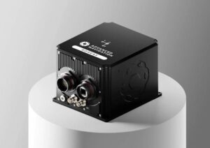
Nortek’s DVL 333 Surface, designed specifically for uncrewed surface vessels (USVs), enables USVs to maintain position or navigate when GNSS is lost.
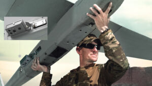
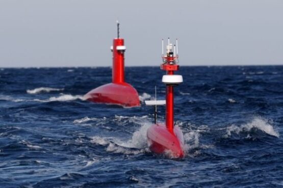
Uncrewed surface vessels (USVs), often called sea drones, help monitor, map and secure the world’s oceans, performing tasks and surveys for less expense and risk than traditional crewed vessels. USVs are used in environmental monitoring, offshore inspection, subsea infrastructure protection, and defense missions such as intelligence, surveillance and reconnaissance (ISR).
USVs require reliable navigation and positioning information, particularly when performing autonomous operations. This information typically comes from GNSS.
But during GNSS outages, USV operators are turning to alternative sensors for positioning. Without GNSS, a sole inertial navigation system (INS) on a vessel quickly drifts outside of acceptable levels when performing dead-reckoning navigation. By adding a Doppler Velocity Log (DVL) to the USV, operators can perform long-distance, dead-reckoning-based positioning with much lower drift.
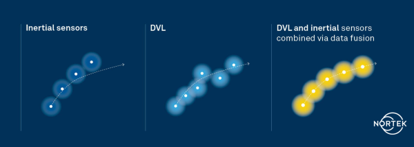
In subsea navigation systems, DVLs provide vehicle velocity information using acoustic returns from the seabed. Because DVLs offer an accurate velocity estimate with no drift, combining a DVL with an INS constrains the drift that would accumulate with an INS alone. Using a DVL allows USVs to maintain position or even navigate without requiring GNSS information, enabling fully autonomous navigation independent of potentially vulnerable signals.
However, deploying DVLs on surface vessels introduces its own set of engineering and operational challenges. Conventional DVLs typically feature protruding transducer heads that are not flush with a vessel’s hull — challenging on smaller or high-speed vessels.
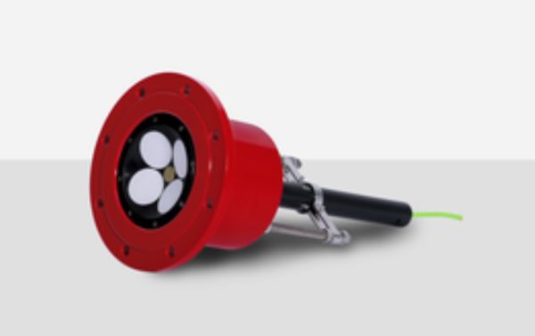
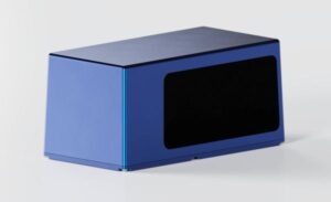
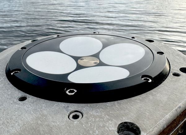
The compact Nortek DVL 333 Surface is designed for flush-hull installation, minimizing drag and protrusion below the hull line. It features a concave, fluid-filled transducer cavity sealed with an acoustic window, allowing for full control of sound velocity and eliminating the need for a hull-mounted speed-of-sound sensor.
When paired with a high-grade INS, the DVL 333 Surface delivers accurate position updates even during GNSS outages or interference. Its 300-meter bottom-track range supports fully autonomous operation in coastal waters, while a water-track mode extends functionality in deeper environments where the bottom is out of range. The DVL333 Surface can also be upgraded to Nortek’s VM Operations vessel-mounted ADCP system. For ease of maintenance, an optional type-certified sea valve allows in-water servicing without dry-docking.
Validating capabilities in the field
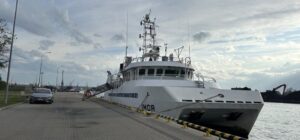
The capabilities of the DVL 333 Surface were demonstrated during field trials in the Oslofjord, an inlet in Norway. The test site presented conditions representative of complex coastal environments, where depth can vary significantly over short distances, and the seabed composition ranges from soft sediment to rock. Unlike uniform test sites with flat, sandy bottoms, the Oslofjord provides a realistic proving ground for challenging navigation scenarios.
“Our goal was to demonstrate that a surface vessel can maintain precise positional accuracy even during a complete GNSS blackout, and to do so in truly challenging coastal conditions,” said Torstein Pedersen, Nortek.
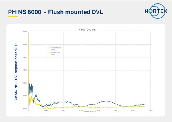
The navigation tests were carried out using a DVL 333 Surface integrated with an Exail PHINS 6000 INS. Although the trial track was relatively short, the system’s performance quickly stabilized, achieving a stable, long-term accuracy of approximately 0.05% of distance traveled (for instance, 50 cm error each 1 km traveled). When bottom track was disabled (simulating operation outside of the DVL 333 Surface’s 300 m bottom track range) and only water track was used with the PHINS INS, the horizontal position error remained within 8 meters over a three-hour run, with the DVL operating solely in water-track mode. In this mode, the INS estimates background currents, which were accurately estimated as weak, stationary currents.
“We were particularly impressed with the performance of the system when using just water track mode,” Pedersen said. “The Exail INS was able to use the water track information to estimate currents and correct for them in the navigation, which is not an easy task to do with accuracy over extended periods. This performance is critical for open water navigation.”
These results confirm that the DVL 333 Surface delivers reliable navigation performance in variable bottom conditions and without a direct speed-of-sound measurement. More importantly, they demonstrate the availability of a commercially available DVL that overcomes the challenges typically faced when adapting subsurface systems for surface platforms.