No audio available for this content.

Propeller Aero has introduced AeroPoints — smart ground-control points designed to make it easy to capture surveyaccurate mapping using drones.
The patent-pending technology provides a simple solution to a major roadblock to widespread commercial drone adoption: accuracy.
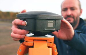
Typical ground control requires establishing precise geolocation position using surveying equipment, and then securing a visible ground marker exactly on the pre-marked GPS point.
AeroPoints are portable ground-control markers, visible from the air and capable of quickly capturing their own positions down to 2-centimeter absolute accuracy.
AeroPoints work with any camera or drone, and integrate seamlessly with Propeller’s cloud-based data platform and processing engine (see above story). They’re solar-powered, durable and weather resistant, and they don’t require any onsite connection.
To use AeroPoints, customers simply lay them down, fly their drone, and then pick them up again. They automatically connect to a wireless or mobile hotspot when back in range to upload captured positional data — and precision georeferencing is done.


Nick Hutton
I think CHC already patented this a year or two ago: http://chcnav.com/index.php/Home/article/detailPage/parentID/1462/cat_id/1463/artID/851
You place their receivers on the ground. Although i like your implementation better as it looks like a target but the CHC system is sub cm.