No audio available for this content.
First of all, let me wish a Happy New Year to all my friends around the world and a prosperous 2014. I’m as excited as I’ve ever been about GNSS technology.
If I may ask for forgiveness from you if you live outside of the United States, I’d like to start out answering a question I’ve been asked about for several years. The question is:
Do you have a list of free sources of RTK base station data in the United States?
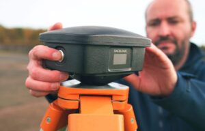
What is RTK? In a nutshell, RTK is 1-2cm real-time positioning. Some refer to it as “survey-grade”. Historically, RTK users have been required to setup and maintain their own RTK base station. This is expensive and inconvenient. Many federal, state and local government agencies have setup RTK bases to increase RTK efficiency for their employees. Many of them make the RTK base data available to the public for free or for a nominal cost. If you work in an area that offers one, all you need is internet access in the field and a RTK-capable GPS L1/L2 receiver.
I’ve tried to keep track of the public RTK bases I know of, so I’ll list them here. If I’ve missed one you know of, please feel free to send me a quick email at egakstatter@gpsworld.com or list it in the Comments section at the end of this article. Furthermore, if you live outside of the U.S., I’d love to hear from you if you know of a source of free RTK base data.
Please note that in the following list there are four types of RTK bases:
- Trimble VRS (network solution).
- Leica Spider (network solution).
- Single baseline (eg. Plate Boundary Observatory and CRTN).
- Topcon TopNet (network solution).
I’ve used an RTK rover on all three of these services. Each of them has several mount points supporting different data formats. I typically use RTCM3 format because it’s an open standard and supported by all services I’ve used. For the Leica Spider network, you’ll be presented a choice of iMAX or MAX. Choose iMAX if you’re not running a Leica rover.
To use any of the services, you’ll need Internet connectivity. In the past, I’ve accomplished this in a few ways:
- SIM card inside a data collector.
- MiFi device.
- Wi-Fi from a work vehicle.
You can also use a commercial RTK Bridge or Repeater such as Intuicom or Base-n-ABox. Or you can create your own RTK bridge system with a notebook computer that has internet access.
No matter how you do it, you’ll need a reliable Internet connection (speed is not important).
You’ll also need some sort of NTRIP software utility. Several data collector software packages have this built-in. For software like ArcPad, DigiTerra, gvSIG, etc. that don’t have it built-in, there are some freeware utilities on the market that run on Windows and Windows Mobile and Android (for example, SXRTN or Lefebure) that handle the NTRIP tasks in the background.
If you want to read a detailed article about the process of logging in to an RTK base using NTRIP, I wrote one last year while I was in Colorado. Click here to have a look. I also published another article entitled “Sources of Public Real-Time High-Precision Corrections” that you might be interested in.
Following is a list of RTK bases in each U.S. state, along with the associated website. Please note that I only list the public (government-operated) services. Also note that while most are free, some of the public operators charge a user fee. At one point or another, I’ve used a fair number of these in various states. Once you’ve used one of each (Trimble, Leica, PBO), the rest are pretty much the same.
The difference between the Trimble and Leica networks and PBO is that the Trimble and Leica networks provide a network solution that utilizes several RTK base stations in the computation. Distance-dependent errors are reasonably modeled so the user can be farther from individual RTK bases. The PBO RTK bases provide a single baseline (like everyone used to use before RTK networks were invented) so the further you are from the RTK base, the more error is introduced into the solution (roughly 1 cm + 1 ppm).
Lastly, there are a number of commercial RTK networks in most of the states listed. I’ll save that list for another day. Again, these are just the publicly run RTK bases.
Alabama – Alabama Department of Transportation. Leica network.
Alaska – Two PBO RTK bases. One in Fairbanks and one in Palmer. Otherwise, no public service.
Arizona – Arizona State Cartographer’s Office. Leica network. Plate Boundary Observatory (single baseline).
Arkansas – No public service.
California – California Real Time Nework (CRTN) (single baseline). Plate Boundary Observatory. Single baseline.
Colorado – Mesa County (Trimble network) and Plate Boundary Observatory (single baseline).
Connecticut – No public service.
Delaware – No public service.
Florida – Florida Department of Transportation. Leica network.
Georgia – No public service.
Hawaii – No public service.
Idaho – Plate Boundary Observatory (single baseline).
Illinois – No public service.
Indiana – Indiana Department of Transportation. Leica network.
Iowa – Iowa Department of Transportation. Leica network.
Kansas – No public service.
Kentucky – Kentucky Transportation Cabinet. Trimble network.
Louisiana – Louisiana State University. Trimble network.
Maine – Maine Department of Transportation. Trimble network.
Maryland – No public service.
Massachusetts – Massachusetts Department of Transportation. Leica network.
Michigan – Michigan Department of Transportation. Leica network.
Minnesota – Department of Transportation. Trimble network.
Mississippi – University of Southern Mississippi. Trimble network.
Missouri – Missouri Department of Transportation. Trimble network.
Montana – Plate Boundary Observatory (single baseline).
Nebraska – No public service.
Nevada – Washoe County. Trimble network. Las Vegas Valley Water District. Leica network. Plate Boundary Observatory (single baseline).
New Hampshire – No public service.
New Jersey – No public service.
New Mexico – Plate Boundary Observatory (single baseline).
New York – New York Department of Transportation. Leica network.
North Carolina – N.C. Department of Environment and Natural Resources. Trimble network. $500 one-time sign-up fee.
North Dakota – No public service.
Ohio – Ohio Department of Transportation. Trimble network.
Oklahoma – No public service.
Oregon – Oregon Department of Transportation. Leica network. Plate Boundary Observatory (single baseline).
Pennsylvania – No public service.
Rhode Island – No public service.
South Carolina – South Carolina Geodetic Survey. Public but charges a usage fee. Trimble network.
South Dakota – No public service.
Tennessee – Tennessee Department of Transportation. Public but charges a usage fee. Topcon network.
Texas – Texas Department of Transportation. Public but only available to TxDOT employees and TxDOT contractors. Trimble network.
Utah – Utah Automated Geographic Reference Center. Public but charges a usage fee. Trimble network. Plate Boundary Observatory (single baseline).
Vermont – Vermont Geodetic Survey. Trimble network.
Virginia – No public service.
Washington – Washington State Reference Network (Seattle Public Utilities). Trimble network. Public but charges a usage fee. Pierce County (Leica Network). Plate Boundary Observatory (single baseline).
West Virginia – West Virginia Department of Transportation. Trimble network.
Wisconsin – Wisconsin Department of Transportation. Trimble network.
Wyoming – Plate Boundary Observatory (single baseline).
Thanks, and see you next time.
Follow me on Twitter at https://twitter.com/GPSGIS_Eric


Peter Hrabak
Hey now, what about Kentucky?! ;-)
Eric Gakstatter
Sorry, I added it. The sad part is that I already had the link to KYCORS…
Joel Cusick
What would be a suggestion or two on how to get movement in your state to supply this. Alaska should be on this….
Eric Gakstatter
The problem with Alaska and RTK is that it’s so spread out. There are PBO RTK bases in Fairbanks and Palmer. There might be some other public ones that just aren’t made public…what’s the DOT doing? Usually, they are a major driver behind RTK networks.
Greg Hazelquist
Hi Eric: Thanks for the list. Very useful. You might consider adding Las Vegas Valley Water District to your list. Website is: http://www.lvvwd.com/eng/references_gps_position.html
Note: To obtain access via the internet using NTRIP, prospective users must contact the District Surveyor at (702) 258-7163 to establish an account with a unique user name and password.
(Leica Spider Network)
Eric Gakstatter
Thanks Greg. I added it.
Michael Brown
Good info Eric, helpful to have.
Sanjay Mishra
What are the options for getting base station services in states not covered by free services? Is there a nationwide provider of services? Are there large regional providers? Thanks
Eric Gakstatter
Hi Sanjay,
The option is to set one up yourself or enter a cooperative agreement to share resources with colleagues to set one up. It’s not very expensive these days to setup and operate one yourself. I just setup a couple of them and it’s pretty straight-forward.
Eric
Clint Davis
Mississippi DOT operates a CORS network. Is there a RTK option for Leica GPS units?
Eric Gakstatter
I looked and haven’t seen one. What’s the link to the MS CORS network?
Robert
Mississippi DOT uses a Trimble network run by Gulf Coast Geospatial Center of University of Southern Mississippi. It does have a free RTK single base side and static data that requires a user account. The website is http://rtn.usm.edu/
Eric Gakstatter
Thanks, I added it.
Jason
Greetings,
The weblink you have the CRTN leads to a 404 page. I believe it should be this:
http://sopac.ucsd.edu/crtn.shtml
Cheers.
Eric Gakstatter
Thanks, I updated the link.
Mark O'Hara
Massachusetts now has a free one:
http://macors.massdot.state.ma.us/spiderweb/frmIndex.aspx
Eric Gakstatter
Thanks Mark, I added it to the list.
elliott
any one know where to get the US governments base station IDs or CIDs. I want to find out what the Cid’s are coming from on programm designed to pull them as I move in the car
they frequently switch at home to different towers in the area. however some towers have been labelled as rogue unknown, which is not common from what I have read.
anyone can help out? I am getting numbers like 77766-1 then I willk get 77766-14 or -7, etc. then it will change fully
thanks in advance