No audio available for this content.
EagleView Technologies is enhancing EagleView Cloud for government users by adding more imagery options. EagleView Cloud is a resource for government departments including tax assessment, geographic information systems and public safety.
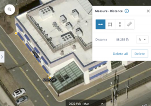
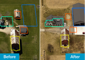
EagleView cloud will now include 1-inch ground sample distance (GSD) aerial imagery. The oblique imagery, usually captured at a 40°- 45° angle, provides enhanced clarity and side-angle views of buildings, homes and properties, enabling government users to view property changes and analyze roads and infrastructure to produce accurate tax assessments.
The company has also added 3-inch GSD orthogonal imagery to the platform. The orthogonal images help government users identify structural changes to buildings, additions to homes, and the condition of impervious surfaces. The images offer a top-down view and can be delivered annually or multiple times per year.
Next, EagleView Cloud aims to be available in commercial industries including insurance, construction and solar.