No audio available for this content.
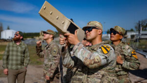
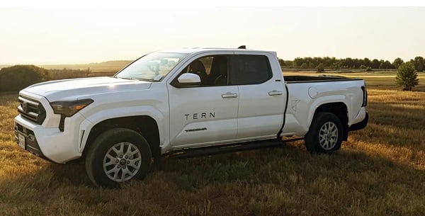
Tern has been named a winner of the U.S. Army’s xTechOverwatch for Unmanned Systems competition. TERN was selected from morethan 600 companies after hands-on Soldier testing at the Bush Combat Development Complex in Bryan, Texas, Oct. 27-29.
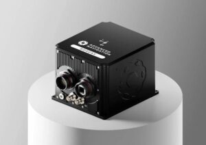
Tern developed an AI-powered Independently Derived Positioning System (IDPS) for position and navigation.
xTechOverwatch is the Army’s premiere event for accelerating autonomous systems, giving
soldiers the opportunity to use emerging technologies in real-world training environments and
provide critical feedback that drives iterative improvement.
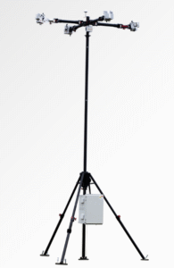
The system has been tested across multiple tactical platforms in both on- and off-road environments, including active conflict zones.
Tern will now integrate IDPS directly with Army Transformation in Contact formations, where active-duty units will continue to validate the system in operational scenarios in 2026.
How IDPS works
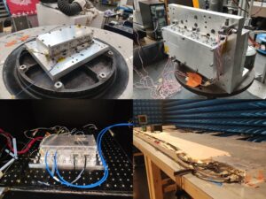
IDPS has been proven to deliver uninterrupted, high-accuracy navigation in environments where GPS fails — tunnels, dense urban canyons, remote terrain, and GPS-denied zones. Tested by the U.S. Department of Transportation, it has sustained ±4-meter accuracy over extended distances without any satellite input, completing more than180 continuous miles GPS-free and performing flawlessly under live GPS spoofing in a conflict zone.
Tern’s IDPS gives the Army the ability to navigate their vehicles without the use of any
satellites, signals or infrastructure, using only map data and the sensors already on board.
Designed by former special operators who spent years navigating contested terrain without
satellite support, and developed with AI experts behind some of the fastest recognition systems
in the world, IDPS maintains precise, real-time location even when GNSS is jammed or
spoofed. The system has been tested across multiple tactical platforms in both on- and off-road environments, including active conflict zones.
Base maps. IDPS has a clear understanding of the roads ahead using preloaded map data — either publicly available or proprietary. This built-in knowledge means it can follow a logical path, even in places where satellites can’t reach, keeping navigation steady from the first turn to the final destination.
IDPS can stand alone or be configured to power a location manager and integrate with widely used navigation applications such as Google Maps, Waze, OSM, ESRI, ArcGIS and Apple Maps.
Sensor data. TERN’s IDPS leverages data from sensors already built into modern vehicles, such as wheel speed, steering angle, and 3D motion data , making these existing sensors smarter. Because this information comes directly from the vehicle, it works anywhere the vehicle can operate, making it a reliable foundation for location tracking in any environment, eliminating the need for additional expensive hardware, such as LEO satellites or terrestrial beacons. With a light computing and processing load, IDPS is can be a hardware or software based solution.
Artificial intelligence. IDPS uses a proprietary AI engine to fuse map data and sensor inputs into a real-time position. TERN’s advanced adaptive weighting algorithms measure and interpret the data from vehicle sensors and recalibrates those inputs in real-time, applied against the base maps to increase accuracy. Constantly self-healing, IDPS predicts, confirms, and refines the vehicle’s location, learning from each movement to maintain pinpoint accuracy without satellites.