No audio available for this content.

The March 22 mudslide in Oso, Washington, has drawn national attention to the danger of landslides. So far, the Snohomish County Medical Examiner’s office confirmed that 39 people had died and seven people remain missing.
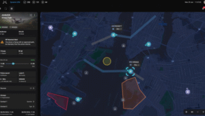
Esri provides an interactive map for users to see where the risk of landslides is low, moderate, or high in the United States.
The map shows landslide suspectibility and incidence data from the USGS, which says this 1982 map was not intended to show landslide areas. Areas with low landslide incidence have been omitted.
Users can click any feature on the map for detailed information about the people living in that area.