No audio available for this content.
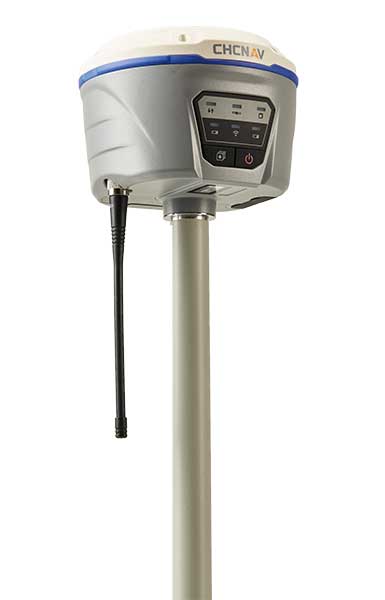
CHC Navigation has unveiled its i50 GNSS receiver, an all-in-one GNSS RTK solution.
The GNSS receiver comes bundled with the CHC HCE320 Android controller and CHC LandStar 7 field data collection software. According to the company, it is a cost-effective solution for topographic and construction positioning tasks in land surveying, small- and medium-sized construction projects, and precision GIS data collection.
“The i50 GNSS is designed to match the demand of cost-conscious yet demanding professionals searching for one all-in-one GNSS RTK survey solution,” said Hans Huang, product manager of GNSS solutions for CHC Navigation. “By integrating field proven GNSS positioning and communication technologies in a compact and rugged unit, land surveyors will experience unmatched work flexibility in their daily field work with CHC i50.”