No audio available for this content.
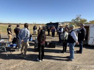
A UAV flight demonstration by Paul Beckwith of DataCapable, a former Navy Civil Engineer, uses the drone cage at the Esri Federal GIS Conference, held Feb. 24-25 in Washington, D.C.
No audio available for this content.
A UAV flight demonstration by Paul Beckwith of DataCapable, a former Navy Civil Engineer, uses the drone cage at the Esri Federal GIS Conference, held Feb. 24-25 in Washington, D.C.
If you enjoyed this article, subscribe to GPS World to receive more articles just like it.