No audio available for this content.
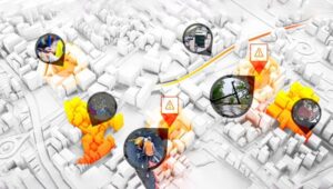
![]() The Open Geospatial Consortium (OGC) is requesting information from interested parties to inform a Concept Development Study (CDS) that will assess the current state and future direction of information standards for modeling, mapping and managing underground infrastructure. Organizations with an interest in underground infrastructure are invited to respond before March 15.
The Open Geospatial Consortium (OGC) is requesting information from interested parties to inform a Concept Development Study (CDS) that will assess the current state and future direction of information standards for modeling, mapping and managing underground infrastructure. Organizations with an interest in underground infrastructure are invited to respond before March 15.
According to OGC, the study will define the scope of a multi-phase underground infrastructure interoperability project. It will also provide an in-depth understanding of the components necessary to enable infrastructure data interoperability and standards in an underground environment.
The CDS is initially focused on urban landscape, but it is extendable, OGC adds. This request for information is the first step in the CDS process.
The Fund for the City of New York, thorough its Center for Geospatial Innovation, has provided support for this project’s conceptualization. In addition, the Singapore Land Authority and Ordnance Survey, Britain’s National Mapping Agency, have contributed to the project.
“In a digitally based society, the lack of comprehensive and reliable data relating to above and particularly below ground assets, will prove to be a barrier to the effective operation of those assets through digital systems,” says Rollo Home, strategic product manager for Ordnance Survey. “We recognize that establishing data as an infrastructure capability will be key to managing assets within an open, secure context. Geospatial data, in particular, can act as the framework within which the inter-relationships across these domains can be identified, modeled and managed.”